Documentation Index
Fetch the complete documentation index at: https://docs.pixxel.space/llms.txt
Use this file to discover all available pages before exploring further.
In geospatial analytics, a spectral index is a calculated numerical value derived from the measurements of electromagnetic radiation across specific wavelengths in the electromagnetic spectrum, often captured by remote sensing instruments. In simpler terms, you can use a spectral index to derive valuable information by the ratio of broadband spectral bands or by applying mathematical operations on available bands. Aurora offers you with two types of indices:
1. Preset Indices
You can use the preset indices, which are pretty common in geospatial studies. A few examples are NDVI, NDWI, VARI, etc. All these presets have different uses and outputs. One of the commonly used preset indices, the Normalized Difference Vegetation Index (NDVI), measures how green and healthy the vegetation is on the Earth’s surface. It is calculated by comparing the amount of near-infrared light (which plants reflect strongly) and red light (which plants absorb) that is reflected by the land cover. NDVI values range from -1 to +1, where higher values indicate more green and dense vegetation and lower values indicate less or no vegetation.Refer to the List of Available Preset Indices here.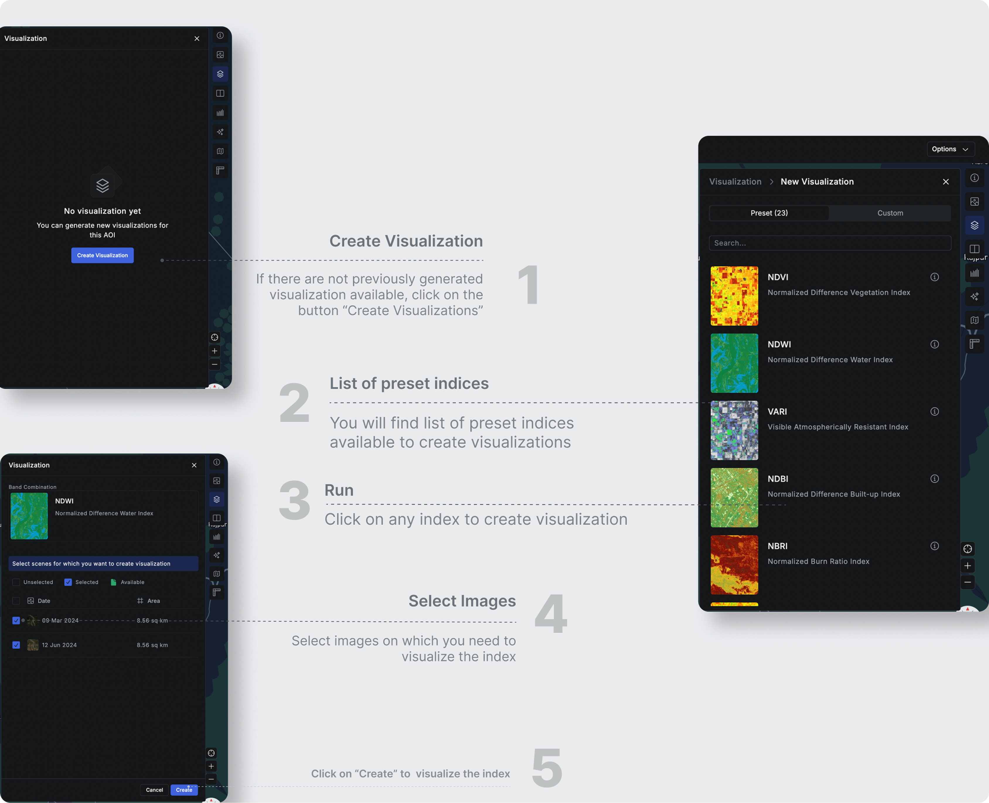
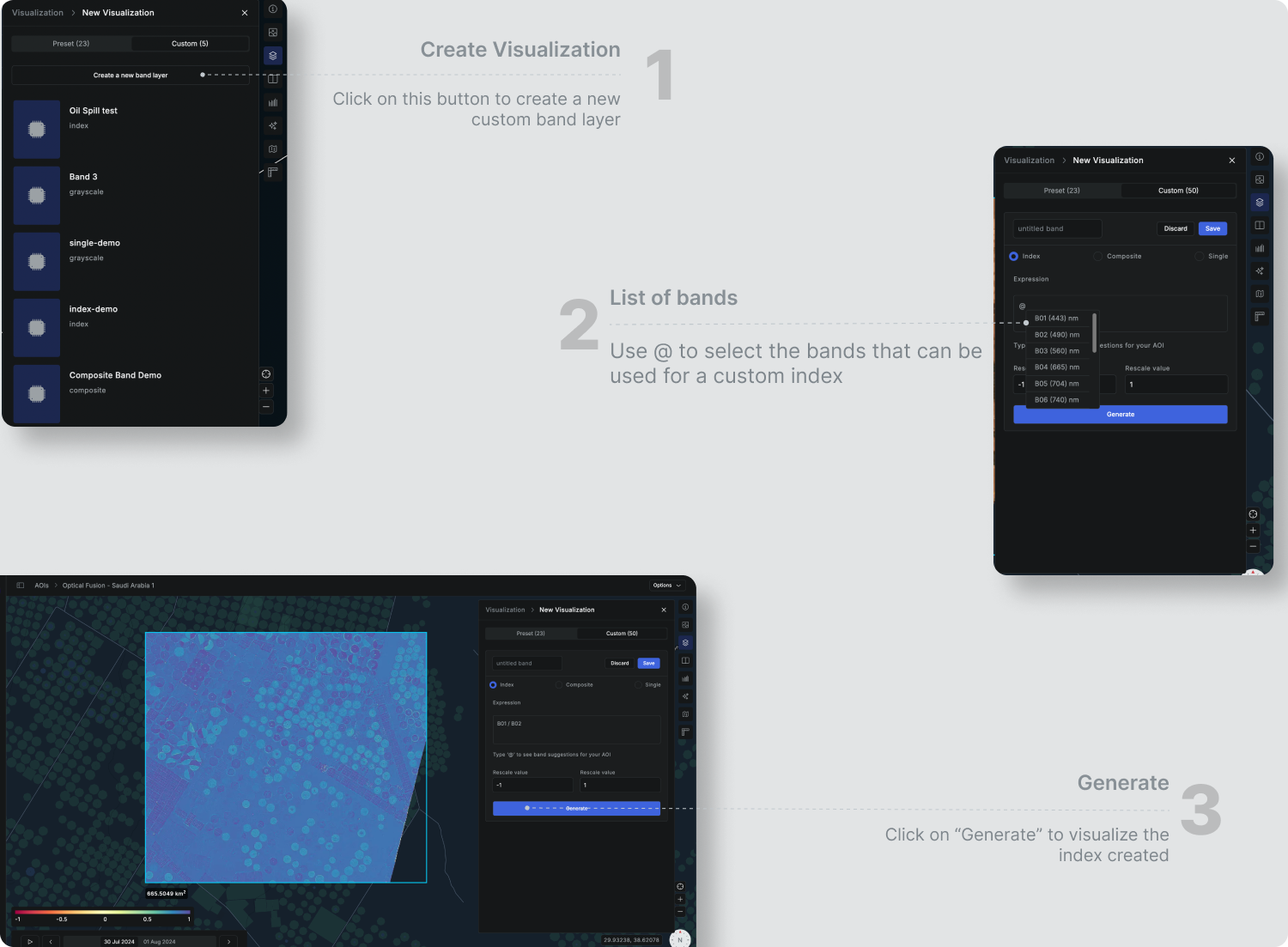
2. Custom Indices
You can create your own custom indices for specific use. Aurora gives you the freedom to experiment or customize how you use the spectral data. You can create any formulations of the bands as per your requirement and visualize the same while tempering with Rescale value at the same time.Follow the below steps to create a custom index.
Note: The custom indices created will be created on the organization level i.e. anyone in your organization can access the index created and saved by you in your AOI.