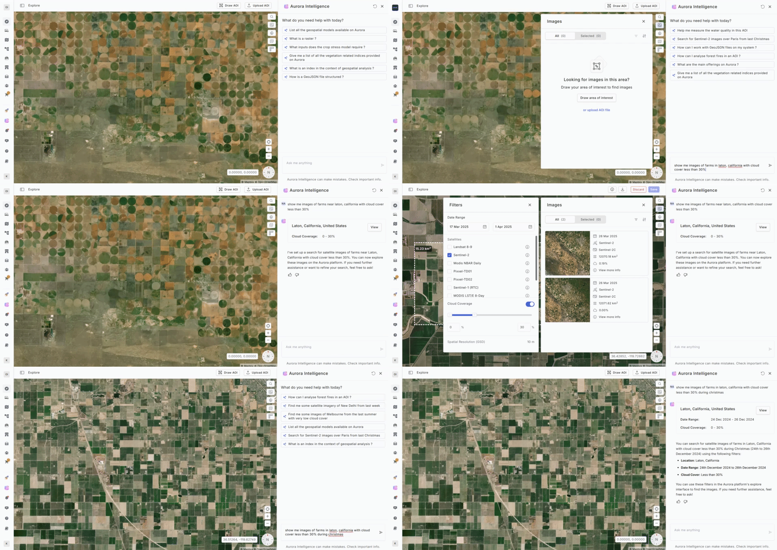
Aurora Intelligence revolutionizes satellite image search by enabling users to locate relevant imagery effortlessly across a wide range of sensors. By leveraging natural language commands, users can define an Area of Interest (AOI), refine search parameters, and retrieve the most suitable satellite images—all without the complexity of manual filtering.
How It Works
- Define Area of Interest (AOI) – Specify a location using a place name, coordinates, or specific addresses.
- Set Search Filters – Apply filters such as date range, satellite choice, cloud cover, spatial resolution, and off-nadir angle.
- Select Results – Choose from a curated list of images that match the search criteria for precise geospatial analysis.

Examples:
- Show pictures of farms in Laton, California : Location only
- Show pictures of farms in Laton, California with cloud cover less than 30% : Location with additional information about cloud cover
- Show pictures of farms in Laton, California around Christmas with cloud cover less than 30%: Location with additional information about cloud cover and time
Required parameters:The user needs to specify the location in the prompt to make aurora intelligence give an output as it is a mandatory parameter. The user can also specify some additional parameters such as:
- Time: The time parameter can be specified by the user in various forms, including exact dates, time frames, events, festivals, or tragedies.
- Satellite: If the user needs images from a particular satellite, then they can specify the satellite name and the co-pilot will return images taken by that satellite
- Cloud Cover: The user can also specify the cloud cover that should be present in the images. They can use words like “clear”, “cloud free”, “no cloud” and many more variations of these words.