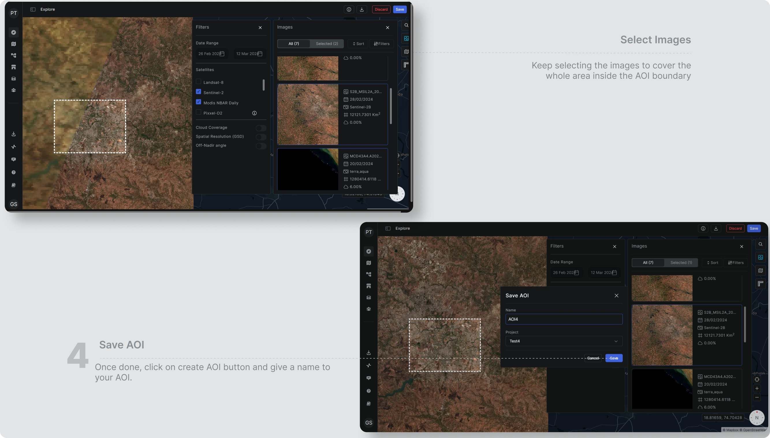
As soon as you are done drawing or uploading the AOI vector file, you will be redirected to the “Search Image” panel. You can find images from all the satellite constellations available on Aurora. Apart from Pixxel-Firefly, Pixxel-TD01 and Pixxel-TD02, we support Sentinel, Landsat, MODIS, and Hyperion constellations for image catalogues. You can browse all the images that cover your AOI fully or partially (depending on the area and geolocation of your AOI.) You will also find a filters panel right next to “Search Images”, which will help you select images according to your needs. Follow the steps below to understand Image selection for AOI creation.
Images gathered from Pixxel and other satellites are presented in raster format. What is a raster? In a raster format, images are composed of a grid of individual pixels, with each pixel assigned a specific value or colour to represent the information collected by the satellite sensor at that location. This grid structure allows for the representation of spatial data in a way that can be easily processed and analyzed using computer software.
A single image is referred to as a tile in Aurora. What is the reason behind this? In satellite imagery, large images are divided into tiles. This allows users to download and view specific areas of interest without needing to download the entire image. Working with tiles makes it more manageable to process and manipulate large geographic datasets, enabling efficient storage and retrieval of information.
Set Date Range
Hundreds of images are captured through various satellites weekly, and we catalog them all on our platform. The “Set Date Range” filter helps you narrow your image search to the desired time. Although, you will find the latest images shown to you by default. Please note that you might not find the image captured yesterday on Aurora because images are processed before they are ready to consume. Hence, it takes an average of 7-10 days for images to appear on Aurora.To set the date range, click on the Start Date and End Date columns to view a calendar dropdown in order to select dates.
Every satellite/constellation has different revisit frequency and different capture time for various parts of the Earth. Therefore, it is possible that you may not be able to find images for a given AOI boundary for a specific date for the selected satellite. You can either try changing the date or try to find images from some other satellite/constellation.
Set Constellation
Space is huge, but mankind has sent hundreds of satellites to bring it closer. Pixxel has also played its part by sending advanced satellites to offer Hyperspectral Imaging (HSI), namely Pixxel-Firefly, Pixxel-TD01 and Pixxel-TD02.You can access images from all the Pixxel Satellites at Aurora, along with multispectral images offered by other space programs. These space programs include Sentinel-1, Sentinel-2, Landsat 8-9, MODIS, and Hyperion.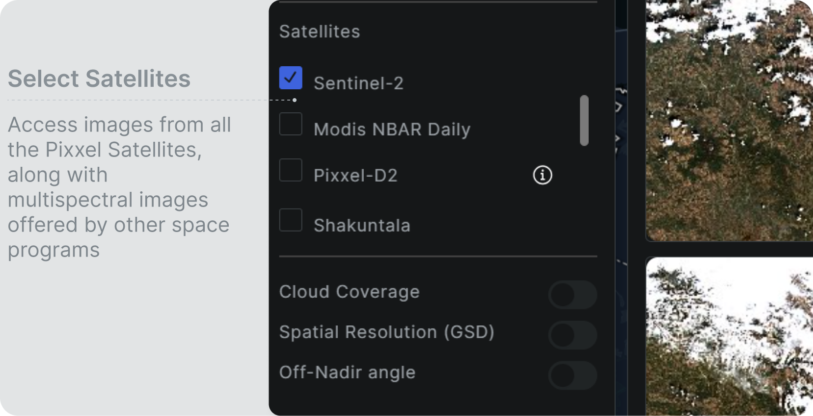
Set Image Filters
Remote sensing images have various parameters, which may sometimes be unwanted and other times wanted specifically for different use cases. You can filter out these parameters on Aurora. Each image filter is explained below:
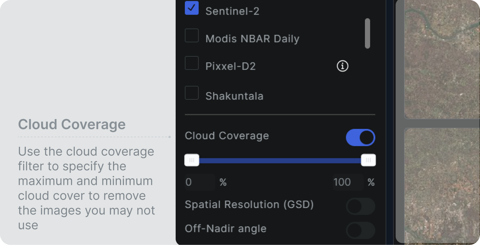
- Cloud Coverage: If you want to analyze an image captured with a resolution much less than what we see on our mobile phones, it better not be cloudy. You will find images for a specific area covered by clouds, often for a specific time range due to the climate there. Hence, it becomes important to segregate the images. You can use the cloud coverage filter to specify the maximum and minimum cloud cover to remove the images you may not use. We suggest keeping cloud cover less than 20% to get good clarity.
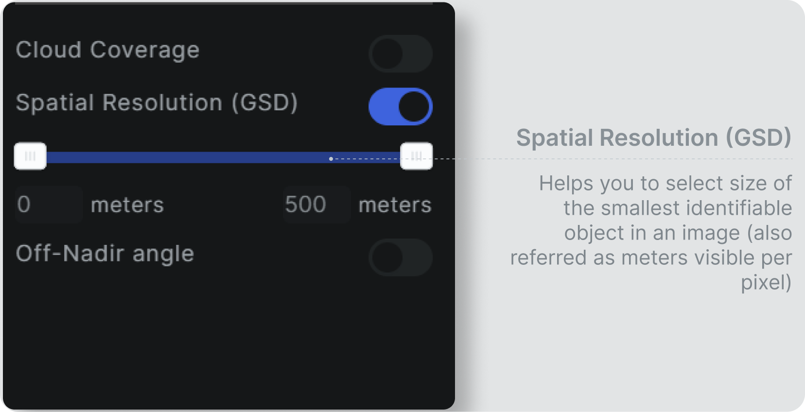
- Spatial Resolution (GSD): Spatial resolution in remote sensing is the level of detail or the smallest discernible feature on the Earth’s surface that can be captured by a remote sensing system, typically expressed in terms of meters per pixel or the size of the smallest identifiable object in an image.
Choosing Images
Choosing the right images for your AOI boundary will help you get the best results. Once you have drawn the AOI boundary, chosen the dates & constellations that suit your needs, and filtered out the best images, you can now select any image to analyze the AOI.
In remote sensing imagery, a “mosaic” refers to an image or dataset created by combining multiple individual images to form a seamless, continuous representation of a larger area. Mosaicking is a common technique used in remote sensing to create more comprehensive and coherent views of the Earth’s surface.
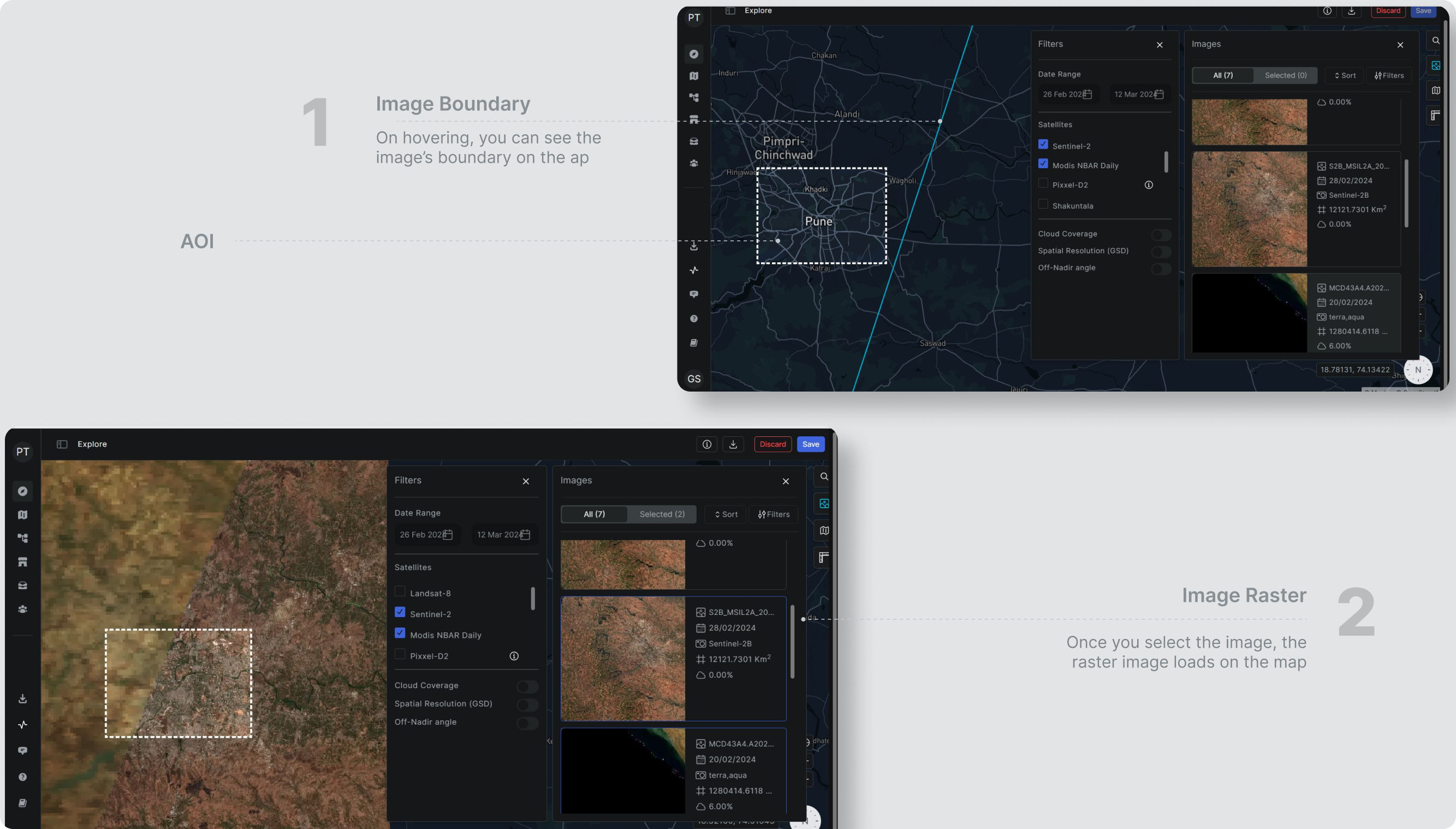
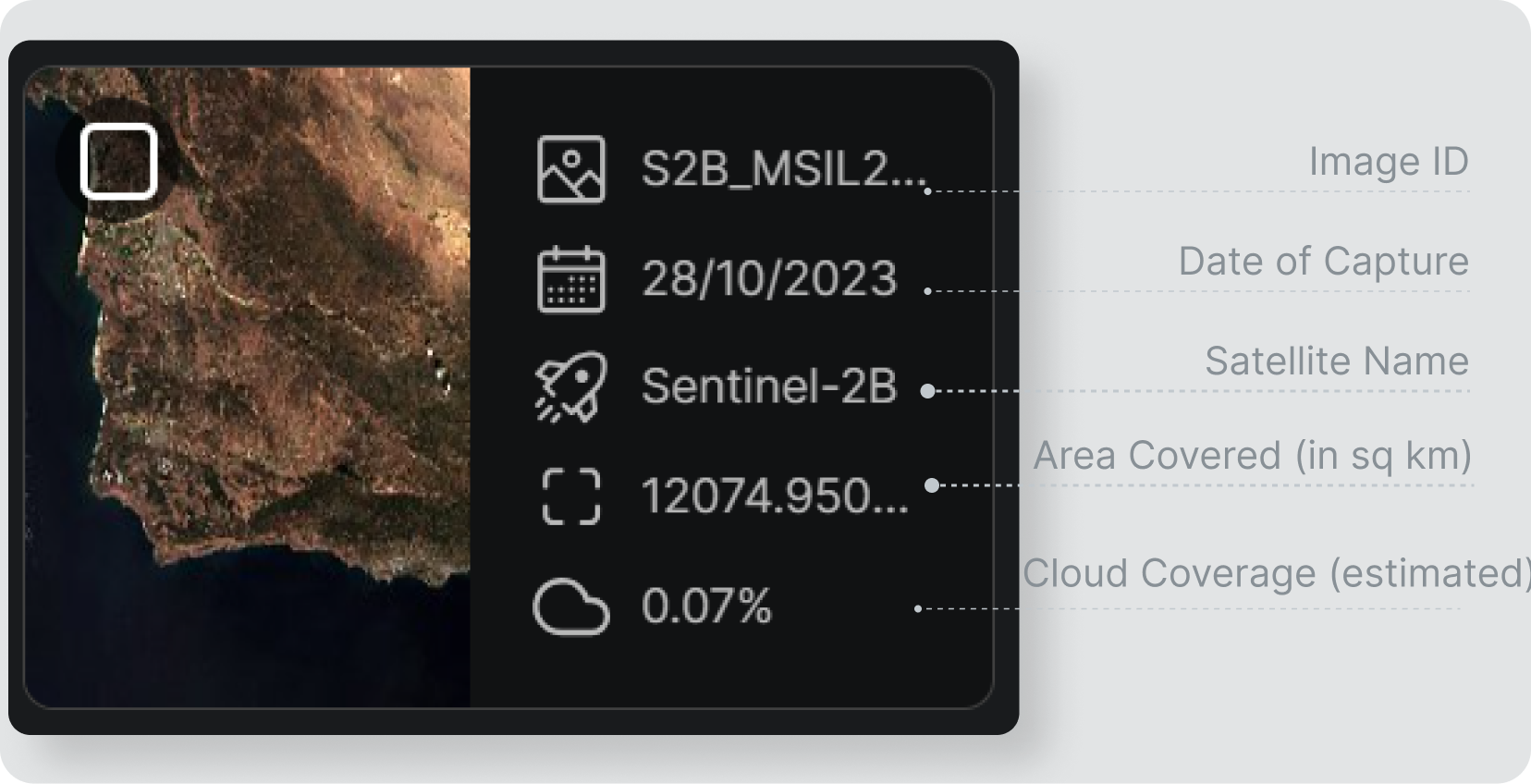
- While selecting images, you can hover over any image to check its boundaries on the map.
- Once you select it, the image raster file will load on the map. This image may or may not cover the whole area inside the AOI boundary.
- Keep selecting other images from the same date or any other to load the full AOI. Don’t worry! we will mosaic these images for you.
- The image selected at the latest will be shown at the top of the one selected earlier for better visualization.
- You can select as many images as possible and from as many dates as possible.
- Once you are done, click on the “Create AOI” button.
Note: This option does not let you replace or remove the already added images.