
Model Overview
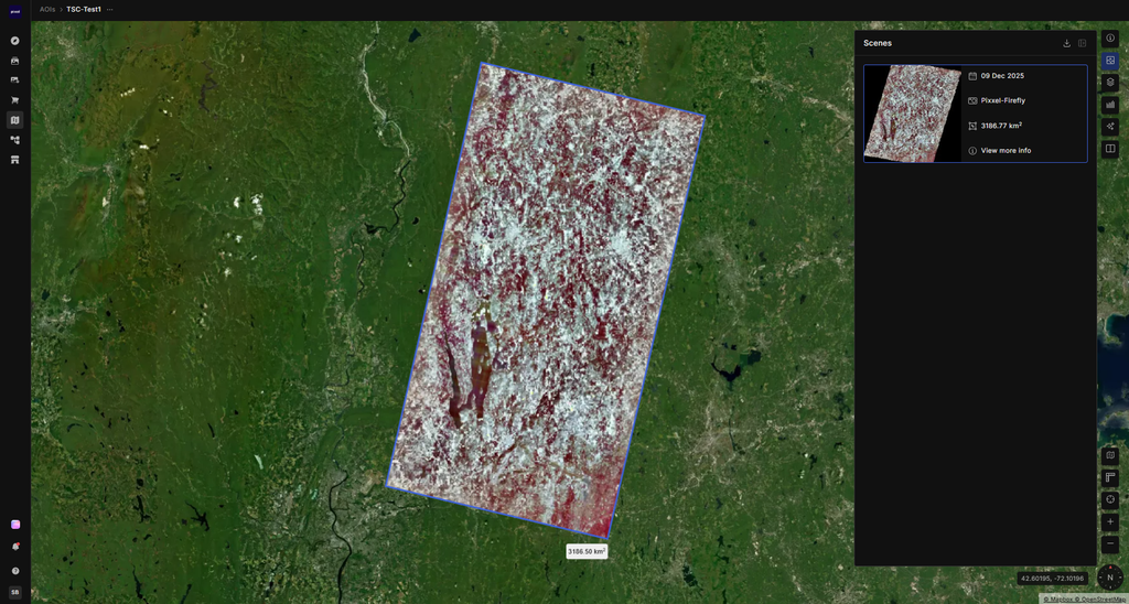
Satellite Data : Firefly (hyperspectral)
The Tree Species Classification model is a tool used in forest remote sensing to determine the species of forest trees present within an area. The model identifies the dominant tree species in a single pixel from among the 10 most-observed species in the USFS database. It uses hyperspectral imagery from the Pixxel Firefly constellation to classify forested land into different tree-species groups.
User Tip: To use this model, select a valid Area of Interest containing forestry land and run the insights.
Model Inputs
Please select a valid Area of Interest containing forestry land.
| Input Name | Description |
|---|---|
| Pixxel TD1 Tile | A tile of satellite imagery from Pixxel TD1. |
Model Output
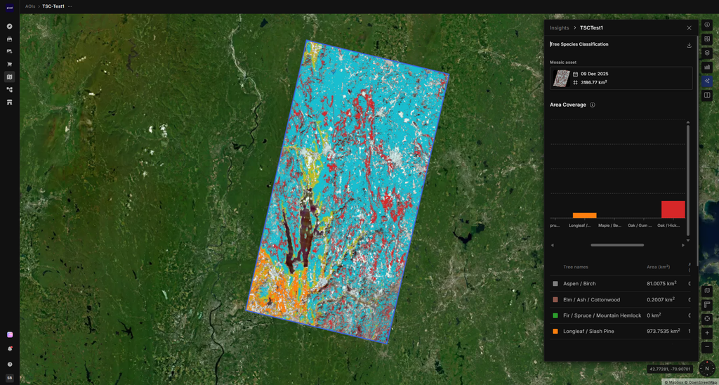
The Area of Interest (AOI) is classified into the 10 classes defined below, and a raster tile is generated as output along with a colour legend for each class. The model first separates forest from non-forest area; non-forest area is rendered transparent so the background mosaic remains visible, and classes are then assigned within the forest area only.
Additionally, percentage and area (in sq km) statistics are shown in a table indicating the area covered by each class within the given AOI. Area percentage is calculated over forest area only.
Class Labels
| Class | Tree Species Group Type |
|---|---|
| 0 | Alder-Maple group |
| 1 | California mixed conifer |
| 2 | Douglas-Fir group |
| 3 | Other species |
| 4 | Ponderosa-Pine group |
| 5 | Redwood group |
| 6 | Tanoak-Laurel group |
| 7 | Western Oak group |
| 8 | Woodland group |
| 9 | Mountain Hemlock group |
Output Files
| S.No. | Output | Description | Download output as |
|---|---|---|---|
| 1 | Classified Raster Tile | A raster tile in which each pixel is assigned a class, along with a colour legend for interpretation against the 10 classes. | .GeoTIFF (single-band raster file) |
| 2 | Table | Percentage and area (in sq km) statistics showing the area covered by each class within the given AOI. | .csv (tabular format) |
Estimated Model Run Time
| Area of Interest Size Range (Sq KMs) | Estimated Model Run Time* (Minutes) |
|---|---|
| 0 – 5000 | 6 |
*Actual time may vary.
Additional Details
Minimum size of Area of Interest required (in Sq KMs.): No limitations
Maximum size of Area of Interest supported (in Sq KMs.): 5000
Geographies supported: North America only
Sensors Supported: Firefly
Model Accuracy: NA for now